-
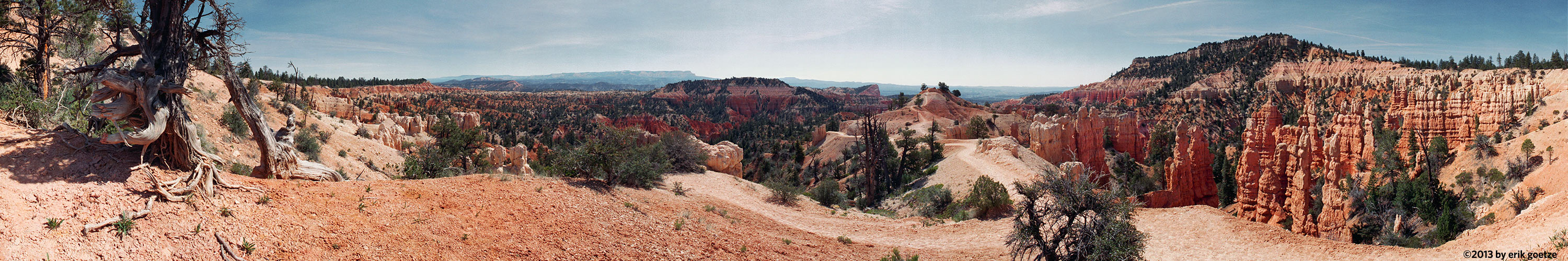 This 360 panorama is from Bryce Canyon, Utah
VirtualParks full-screen list
List of FullScreen panoramas at VirtualParks
Free to view. Click on link or thumbnail to open scene in a new full-screen window. Warning: Large files may take awhile to stream in -- these scenes are all high-resolution files (~2MB), presented in fullscreen mode to provide maximum immersion
| Place | Thumbnail | Filesize | Quality ranking | Camera used | Can see | Notes |
|---|---|---|---|---|---|---|
| Ridge Trail at top of hill, Russian Ridge Open Space |  | 1576 KB | 675 | Canon T90 | Many wildflowers in bloom, some visible here. Somewhat hazy towards the Bay, but clear to west. | |
| Viewpoint off Ancient Oaks trail, Russian Ridge Open Space |  | 1714 KB | 714 | Canon T90 | More poppies and green grass everywhere; in the distance an Open Space Preserve group are eating lunch under the oaks. | |
| Horse Camp, Sam MacDonald County Park |  | 1927 KB | 801 | Canon T90 | Spring, deer were grazing | |
| Sanborn Skyline Park, Sanborn Skyline County Park |  | 1959 KB | 805 | Canon T90 | A lush world of ferns and other greenery. | |
| Crystal Springs Res., Fish and Game Refuge San Francisco Water Dept. |  | 1578 KB | 1026 | Canon T90 | ||
| Horseshoe Lake, Skyline Ridge Preserve |  | 1612 KB | 817 | Canon T90 | Muddy after the rains | |
| JMT-Just below Mono Creek Trail cutoff, Sierra National Forest |  | 3249 KB | 205 | Nikon N65 | Bear Ridge | |
| Piute Pass nr 2, Sierra National Forest |  | 3093 KB | 76 | Nikon N90s | Mt. Humphreys, Puite Lake | From a rock outcrop just east of the high point of the pass |
| Lagunita , Stanford University Campus |  | 1962 KB | 973 | Canon T90 | After the January 96 rains, was pretty full | |
| Canyon View Trail nr 1, Sunol Regional Park |  | 4300 KB | 0 | E5000V1.6 | Serpentine soil here | |
| Canyon View Trail nr 10, Sunol Regional Park |  | 3675 KB | 162 | E5000V1.6 | Little Yosemite area, Alameda Creek, Ohlone Wilderness | Shot with a home-made panhead |
| Canyon View Trail nr 2, Sunol Regional Park |  | 3716 KB | 0 | E5000V1.6 | ||
| Canyon View Trail nr 6, Sunol Regional Park |  | 3865 KB | 0 | E5000V1.6 | ||
| Mt. Tam, Mt. Tamalpais State Park |  | 1628 KB | 519 | Canon T90 | Wonderful view of the Bay from slightly below top of Mt. Tam | |
| Gilman Lake, Toiyabe National Forest |  | 2503 KB | 561 | Nikon N90s | ||
| Green Creek nr 1, Toiyabe National Forest |  | 2408 KB | 292 | Nikon N90s | Near trailhead. | |
| Green Creek nr 2, Toiyabe National Forest |  | 2435 KB | 559 | Nikon N90s | Amidst a sea of aspens. | |
| Hoover Lake nr 1, Toiyabe National Forest |  | 2610 KB | 339 | Nikon N90s | Another rock field | |
| Coast cliffs overlooking sea lion spot, Wilder Ranch State Park |  | 1601 KB | 673 | Canon T90 | ||
| Coast viewpoint, Wilder Ranch State Park |  | 1288 KB | 672 | Canon T90 |
For a different panorama every day, visit VRlog.com, which works in all popular browsers and supports fullscreen viewing and WebVR.